


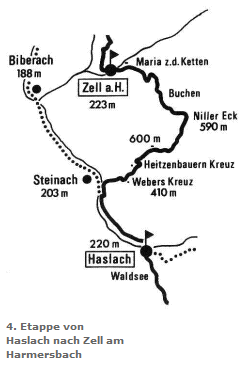
Stage 4:
Haslach - Zell am Harmersbach
HASLACH – Kinzig bridge – Kinzig dam - underpass (B33) (4 km) - Webers Kreuz - Oberentersbacher Hütte - Niller Eck/Buchen (10 km) - Buchwaldhof - pilgrimage church Maria zu den Ketten - ZELL AM HARMERSBACH (5 km).
Alternative along the valley: Haslach – Kinzig dam – Kinzig footbridge – Kinzig dam - Biberach - Gengenbach (16 km)

From Haslacher town hall (220 m) the shell sign leads to the railway station, through an underpass to the right bank of the Kinzig - along the Kinzig - past the villages of Schnellingen and Bollenbach.
Shortly before the footbridge we leave the Kinzig dam (left Steinach), pass under the road on the right, turn left, walk uphill on a timber road and continue on a narrow serpentine path to Weberskreuz (410 m). From there uphill towards Katzenstein - past Heizenbauern Kreuz to the highest point of the ascent, Welschbollenbacher Eck (600 m).
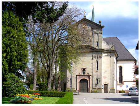
The trail continues slightly downhill to the Oberentersbacher Hütte (hut) - a refugio - and then follows a slight ascent to the ridge line between Fischerbach and Oberentersbach - over the "Eck" (550 m) with a magnificent view of the Kohlplatz. Keep going downhill continuously - past the Buchwaldhof (290 m) to Unterharmersbach - all the way down into the valley to the Zeller pilgrimage church - the end of this day's stage.

3. Etappe:
Wolfach - Haslach
